


Voting District 060004, Fulton County, New York
About
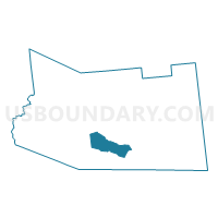
Outline

Summary
| Unique Area Identifier | 627276 |
| Name | Voting District 060004 |
| County | Fulton County |
| State | New York |
| Area (square miles) | 13.99 |
| Land Area (square miles) | 13.80 |
| Water Area (square miles) | 0.19 |
| % of Land Area | 98.64 |
| % of Water Area | 1.36 |
| Latitude of the Internal Point | 43.04473010 |
| Longtitude of the Internal Point | -74.43897920 |
Maps


Graphs
Select a template below for downloading or customizing gragh for Voting District 060004, Fulton County, New York


Neighbors
Neighoring Voting District (by Name) Neighboring Voting District on the Map
- Voting District 030001, Fulton County, NY
- Voting District 040001, Fulton County, NY
- Voting District 040002, Fulton County, NY
- Voting District 050201, Fulton County, NY
- Voting District 050402, Fulton County, NY
- Voting District 060003, Fulton County, NY
- Voting District 060005, Fulton County, NY
- Voting District 070102, Fulton County, NY
Top 10 Neighboring County Subdivision (by Population) Neighboring County Subdivision on the Map
- Gloversville city, Fulton County, NY (15,665)
- Johnstown city, Fulton County, NY (8,743)
- Johnstown town, Fulton County, NY (7,098)
- Ephratah town, Fulton County, NY (1,682)
- Caroga town, Fulton County, NY (1,205)
Top 10 Neighboring Place (by Population) Neighboring Place on the Map
Top 10 Neighboring Elementary School District (by Population) Neighboring Elementary School District on the Map
Top 10 Neighboring Unified School District (by Population) Neighboring Unified School District on the Map
- Gloversville City School District, NY (19,244)
- Johnstown City School District, NY (11,690)
- Oppenheim-Ephratah Central School District, NY (2,725)
Top 10 Neighboring State Legislative District Lower Chamber (by Population) Neighboring State Legislative District Lower Chamber on the Map
Top 10 Neighboring State Legislative District Upper Chamber (by Population) Neighboring State Legislative District Upper Chamber on the Map
Top 10 Neighboring 111th Congressional District (by Population) Neighboring 111th Congressional District on the Map
Top 10 Neighboring Census Tract (by Population) Neighboring Census Tract on the Map
- Census Tract 9706, Fulton County, NY (7,117)
- Census Tract 9713, Fulton County, NY (4,702)
- Census Tract 9705, Fulton County, NY (4,216)
- Census Tract 9712, Fulton County, NY (4,022)
- Census Tract 9708, Fulton County, NY (3,043)
- Census Tract 9704, Fulton County, NY (1,738)